Coordinate every responsefrom one command platform.
Unify incidents, GIS, video, sensors, mobile responders, and the systems you already run into one operational picture — and coordinate the response from one place.
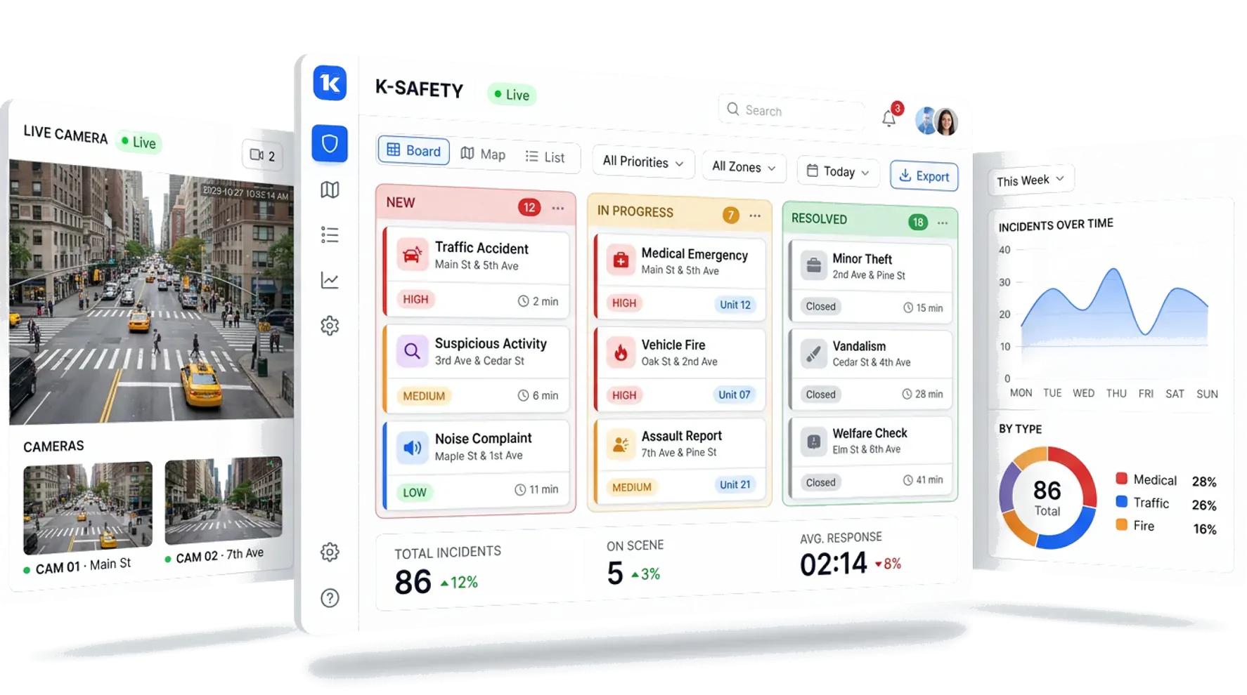
Smarter, connected public safety operations.
Safety management
Automates event handling from detection to resolution, cutting response time and manual coordination.
Connected ecosystem
Integrates with the VMS, LPR, IoT sensors, and radio systems already in your operation.
Real-time intelligence
Surfaces priority, context, and recommended workflows so operators decide in seconds.
Scalable deployment
Cloud or on-premises. Scales from a single city to a statewide command operation.
One picture. Every source.
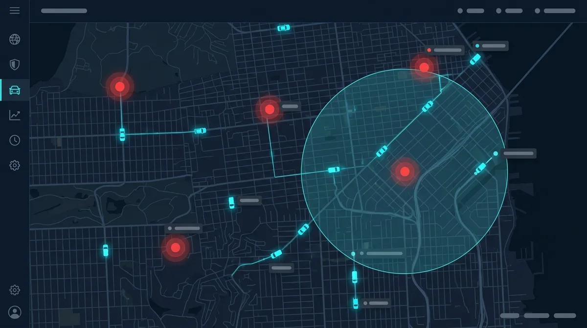
Live operational map
Incidents, units, cameras, and sensors on one GIS view — with live unit tracking and geofenced zones.
- GIS mapping with live unit tracking
- Zone management & geofencing
- Camera and sensor layers
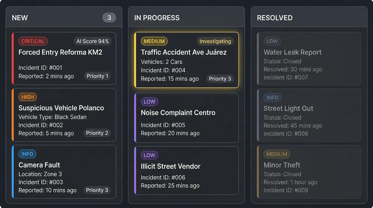
Event handling & workflows
Every signal becomes a tracked event with priority, assignment, SOPs, and a full audit trail.
- Automated detection & alerting
- Prioritization and SOPs
- Complete incident audit trail
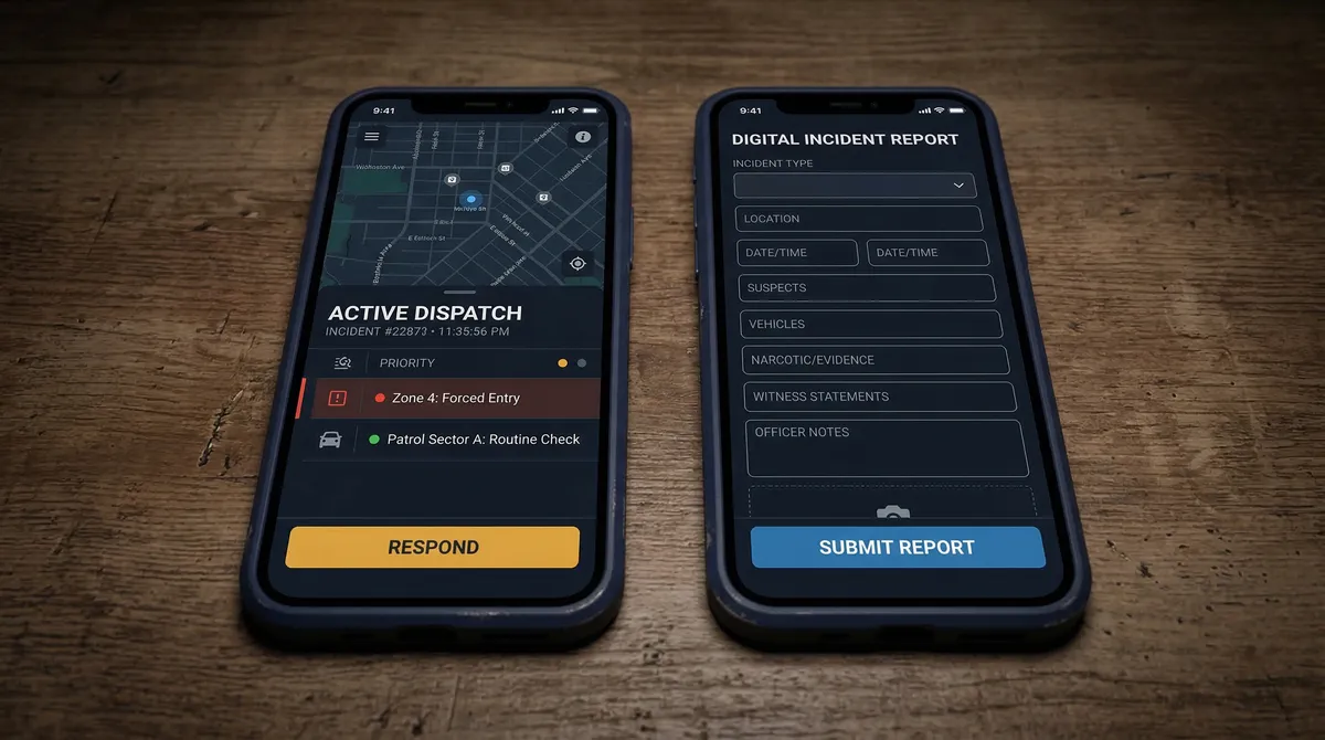
Field & multi-agency response
Push the incident to responders with full context, and keep every agency working the same event.
- Mobile apps for field responders
- Panic button & IoT sensor network
- Cross-agency coordination
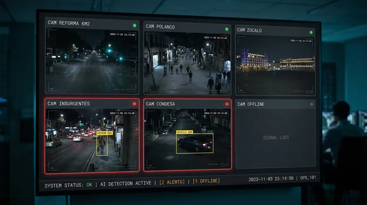
Video & intelligence
Bring every camera into the command picture, with analytics that flag what matters before it escalates.
- Video Management System (VMS) integration
- AI-powered threat forecasting
- LPR, object & anomaly detection
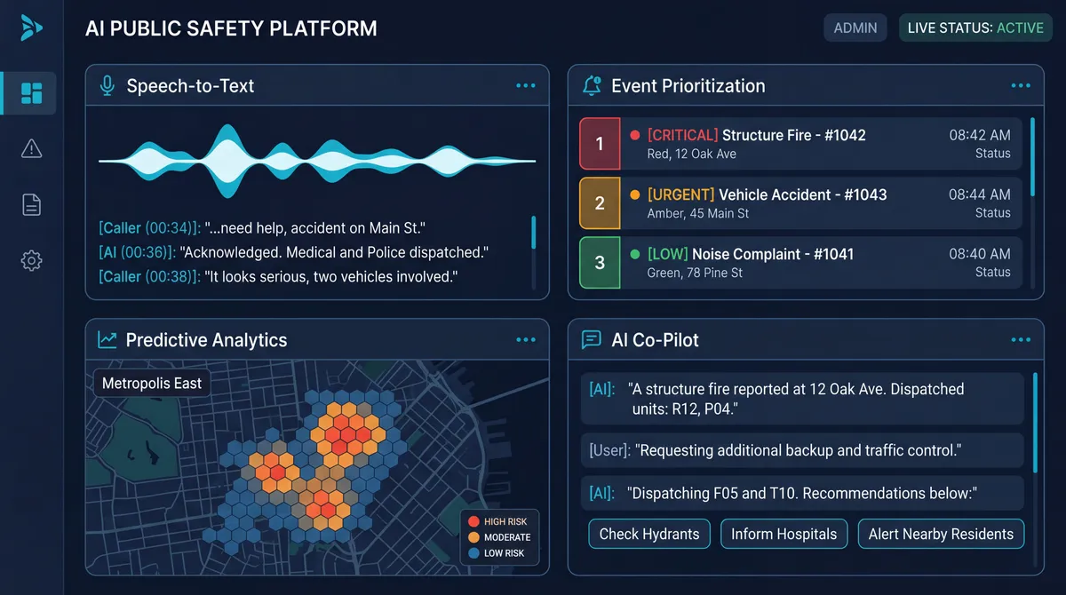
AI engine
AI reads the incoming signals, scores what matters, and recommends the next action — so operators act on judgement, not noise.
- Automated detection & risk scoring
- Recommended response workflows
- Pattern and anomaly analysis
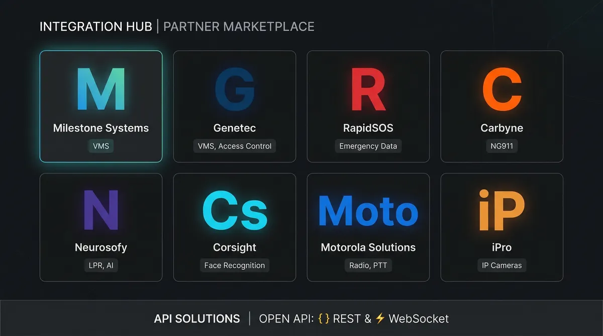
Integrations layer
Open APIs and prebuilt connectors bring your existing cameras, CAD, radio, and sensors into one operation — no rip-and-replace.
- Open APIs & prebuilt connectors
- Works with existing infrastructure
- Add systems without new silos
From raw data to resolved incident.
Connects to the infrastructure you already operate.
K-Safety layers on top of existing systems — no rip-and-replace.
Video management systems
CCTV, IP cameras, body cams, drone feeds.
Communication & dispatch
Radio systems, CAD platforms, interagency tools.
Analytics & AI
LPR, object and anomaly detection, gunshot detection.
Critical infrastructure & IoT
Radars, fire sensors, smart fences, environmental monitors.
Emergency response tools
Panic buttons, 911 CAD, mobile responder apps.
GIS & mapping
Real-time mapping, routing, zone management, geofencing.
About K-Safety.
What is K-Safety?
How does K-Safety provide situational awareness?
What modules does K-Safety integrate?
Who uses K-Safety?
How does K-Safety compare to traditional PSIM?
Connected sensors & cameras
K-Safety powers one of Latin America’s most advanced public safety command operations — unifying video, sensors, and field response across the state into a single coordinated operating picture.
Deployment details subject to customer approval.